Wisconsin Regional Orthoimagery Consortium 2025
2026 Engineering Excellence State Finalist
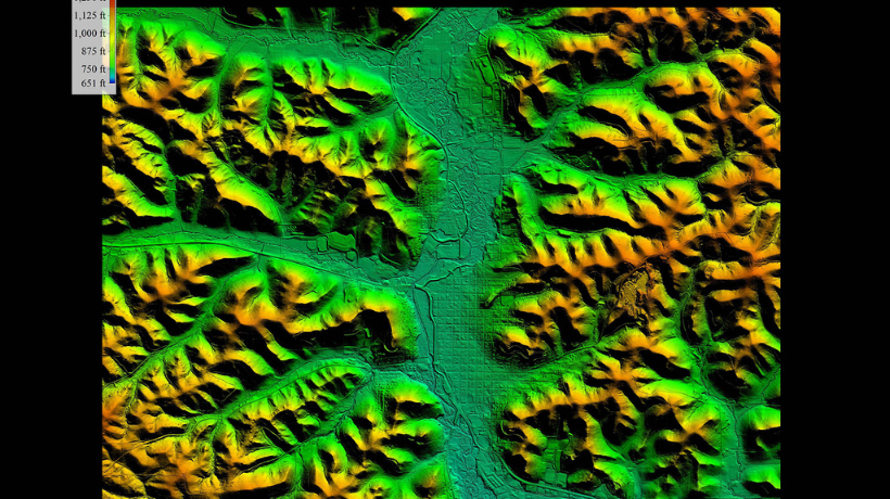
![]()
Entering Firm: Ayres
Client: North Central Wisconsin Regional Planning Commission
The Wisconsin Regional Orthoimagery Consortium (WROC) has grown over four decades into a statewide, collaborative program that provides high-quality geospatial data to support land information and public decision-making. Orthoimagery is an aerial photo that is corrected to follow a specific scale. It has long been used as a base layer for engineering, planning, public safety, and conservation efforts. Simply put, the more detail, the better. Statewide imagery will be publicly accessible, with expanded options for viewing and downloading. This accessibility supports surveying, engineering, public safety, conservation and cross-jurisdictional coordination.
Engineers led a statewide effort that brings high-resolution geospatial data to the public for improved results across a huge array of uses.
Ayres led the initiative, overseeing program development, project management, contracting, funding, flight planning, and data processing. Wisconsin achieved statewide 12-inch-pixel orthoimagery on a five-year update cycle, a significant achievement that provides better results for everything from road design to landscaping to emergency services. During this cycle, the team coordinated more than 100 individual projects, secured financial support, and executed complex aerial survey missions within the narrow spring flying window. WROC’s model sets it apart by enabling diverse participants to share costs and resources, resulting in higher-resolution orthoimagery and lidar data at significantly reduced cost.
Despite the challenge of planning and completing flights across 56,000 square miles during the compressed two-month spring season, Ayres delivered customized datasets on schedule to more than 100 partners, reaffirming WROC’s role as a foundational element of Wisconsin’s geospatial infrastructure.